Modeling the Dynamics: Future Marsh for Horseshoe Crabs
- Time: 2024.08 - 2024.12, Academic work
- Collaboration: Chaowu Li
- Location: Maurice River, New Jersey
- Medium: Aquaveo SMS (SRH-2D), SLAMM, Sediment Table, Grasshopper, Rhino, Adobe Suite, 3D Printing
Project description
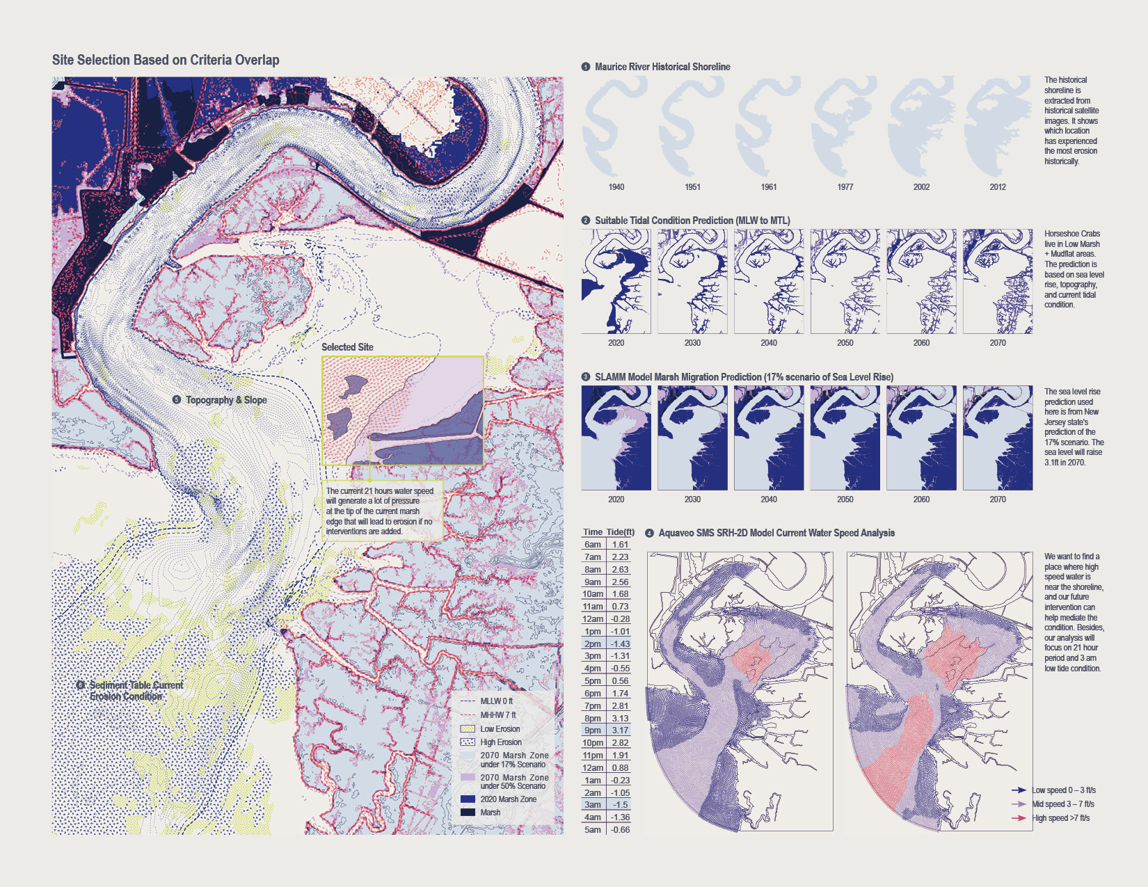
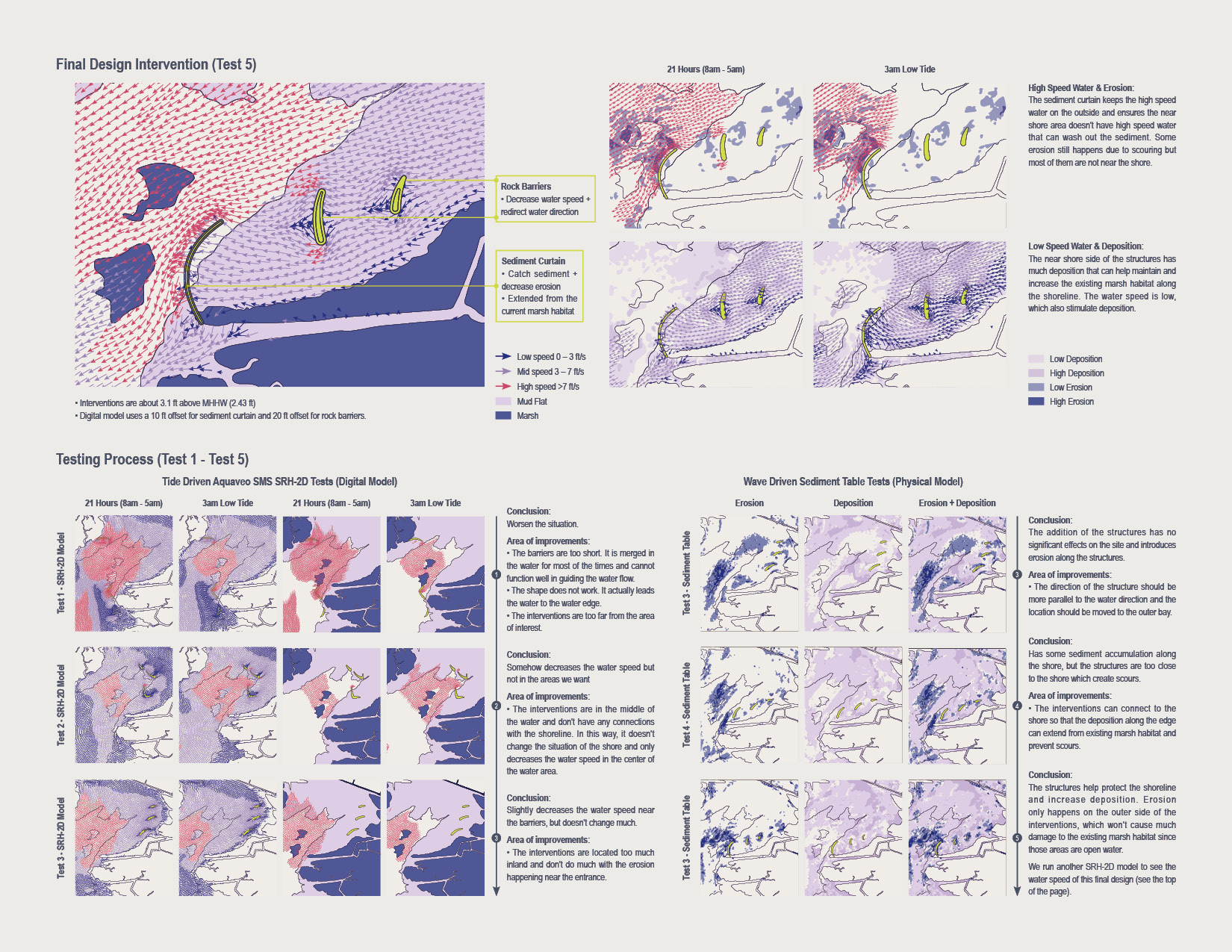
This project aims to use both the digital (SLAMM, Aquaveo) and physical model (sediment table) to create future marsh habitats for juvenile horseshoe crabs. It starts with the existing condition analysis and criteria overlapping to find the area of interest. Then, it goes through multiple iterations to design the actual shape and direction of the breakwater.
Horseshoe crabs (Limulus polyphemus) are marine arthropods found along the Atlantic coast, ranging from northern Maine to the Yucatan Peninsula and the Gulf of Mexico. Delaware Bay hosts the largest spawning population of horseshoe crabs in the world, and our site, Maurice River, is a brunch that flows into Delaware Bay.
The eggs of horseshoe crabs play a crucial ecological role in the food web. The Delaware Bay Estuary is the largest staging area for shorebirds along the Atlantic Flyway, and horseshoe crab is an important food source.
Each year, during late spring and early summer, horseshoe crabs migrate from deep ocean to sandy beaches to lay eggs. It takes approximately 16 molts and around ten years for horseshoe crabs to reach maturity, and during this period, low marsh and mud flat area is the ideal habitat for these juveniles.
Horseshoe crabs are also important to humans. The historical harvest of them as bait for commercial fisheries significantly decreased the population. Additionally, the biomedical industry utilizes their blood to test medical products for bacterial contamination.
As the sea level rises, Maurice River will experience significant marsh and mud flat loss in the future, which will erase most of the habitat for juvenile horseshoe crabs. In this way, our design intended to find a place along the shoreline that can serve as a refugee. The project intends to create natural sediment deposition next to the current marsh edge that can connect to the current marsh habitat, which will add ecological resiliency.